I’ve just submitted a PR #5673 in order to add an option to the map visualization.
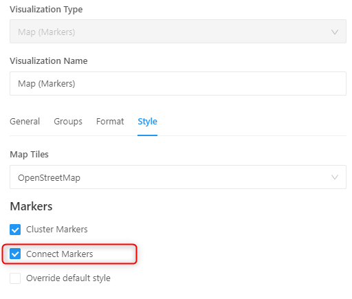
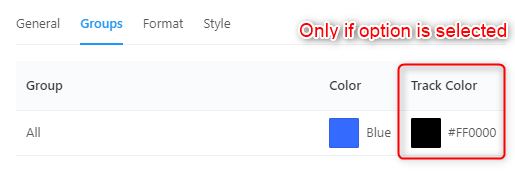
If the option is activated the markers are connected and a new layer is created on the map

Colors can be selected
My first contribution to the project; Hope it will help