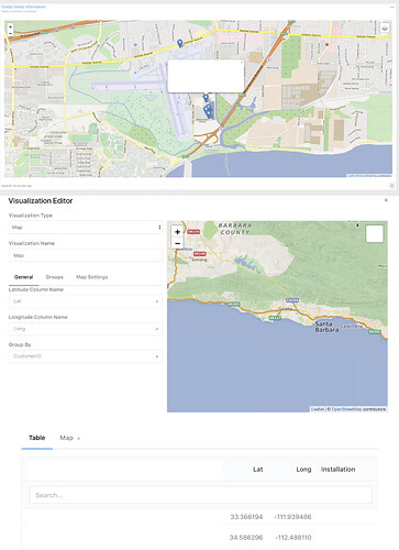
When running version 3, I was able to make a working map under a single account using decimal format Lat and Long coordinates for pins. However when I tried to do this again, the Lat and Long (stored as Numbers in a DynamoDB) came bat truncated to 2 decimal places, and no map would render.
I saw version 4 beta came out, and thought I’d check and see if the decimal place truncating issue which had been resolved would fix the map issue (possibly not enough decimal places being passed to the Map visualization). This didn’t work, and the dashboard that used to work in version 3 would simply not function at all under version 4. It is nice that all the decimal places are there, however.
Here’s an assembly of screenshots of Version 3 Map working, Version 4 showing no items, and an example of the table generated by the query (Lat/Long in decimal formats).

